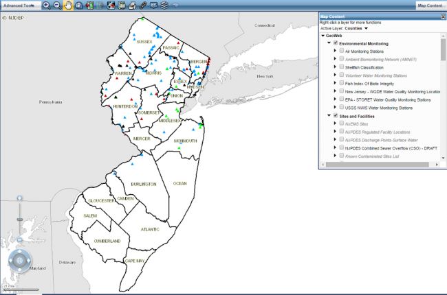
The New Jersey Department of Environmental Protection's GeoWeb Map Viewer provides a large amount of information on New Jersey's geology, natural resources, and environmental management in interactive map form, including:
- Surface and bedrock geology
- Hazards - earthquakes, landslides, drought
- Water resources and water quality
- Land use
- Environmental monitoring and management
- Aerial imagery - both natural and infrared
- Historical maps
The map allows users to select multiple layers that can be overlain on each other. By doing this, users can see how different features are related. Additional layers include congressional and legislative districts, allowing users to identify how particular issues relate to their area.
Click here to access the GeoWeb Map Viewer

