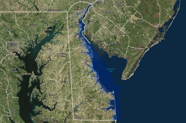
The Delaware Sea Level Rise Inundation map shows how various extents of future sea level rise (0.5, 1.0, and 1.5 meters) would affect flooding in coastal Delaware. For each scenario, users can see the areas that would be flooded during an average higher tide (Mean Higher High Water). The map does not include the effects of erosion, subsidence, or future construction.
Users can search by location to see the effects on individual areas.
Click here to access the interactive map.
Source: Delaware Department of Natural Resources and Environmental Control

