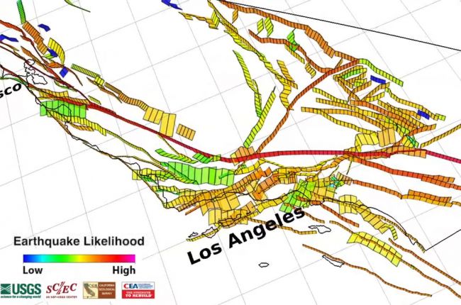
In 2015. the Working Group on California Earthquake Probabilities - a collaboration between the U.S. Geological Survey, the California Geological Survey, and the Southern California Earthquake Center (SCEC) - released the Third California Earthquake Rupture Forecast (UCERF3). A visualization was produced to accompany this release, showing the progress of fault modelling in California and the updated earthquake likelihood map.
Click here to view the UCERF3 video on YouTube. A factsheet on the model is also available, and a .kmz file for viewing the earthquake likelihood map in Google Earth can be found on the SCEC website.
Source: Working Group on California Earthquake Probabilities

