Learning Outcomes
These indicate what you should understand and be able to do as a result of the section. Each Learning Outcome highlights one main practice of science or engineering that you will use to investigate and explore ideas of Earth and space sciences and key crosscutting concepts that are common among all the sciences.
Section 1: Global Wind Patterns and Weather
- Analyze data on world maps to identify patterns in incoming solar radiation, air temperature range, and air pressure at Earth’s surface.
- Use a model to explain the factors that affect the global movement of air in Earth’s atmosphere.
- Obtain information about global wind belts and patterns of circulation in Earth’s atmosphere.
- Carry out investigations to explain the effects of different temperatures on the density of a volume of air.
- Analyze data on a map of the United States to identify regional air masses.
- Carry out an investigation that measures the elements that make up weather.
- Obtain information about the effects that result from the interaction of different types of air masses.
Section 3: Thunderstorms and Flash Floods
- Analyze data to explain the relationship between the frequency of thunderstorms and topography.
- Analyze data on a topographic map to determine areas of a drainage basin at risk for flooding.
- Analyze data on a local topographic map to explain the vulnerability of your community to flooding.
Section 4: Severe Winds and Tornadoes
- Analyze and interpret data to explain the relationship between tornado and thunderstorm distribution across the United States.
- Analyze data to explain the relationship between tornado frequency and time of year.
- Use a model that illustrates the direction of flow of downburst winds.
- Obtain information about the hazards posed by tornadoes and downbursts.
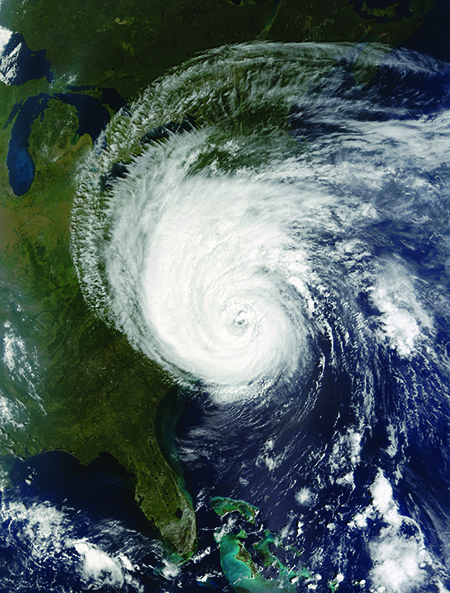
Section 5: Tropical Storms and Hurricanes
- Analyze and interpret data to explain where in the United States hurricanes occur.
- Analyze data to explain the relationship between hurricane frequency and time of year.
- Analyze data to explain how a hurricane’s strength changes as it moves.
- Obtain information about the hazards posed by hurricanes.
Section 6: The Surface Circulation of the Ocean
- Analyze data to determine the direction and rate of flow of ocean surface currents in the North Pacific Ocean.
- Analyze and interpret data to explain the relationship between global patterns of surface winds and ocean surface currents.
- Obtain information about the role of ocean surface currents in Earth’s global climate system.
Section 7: The Deep Circulation of the Ocean
- Use a model to explain the effects of temperature on ocean circulation.
- Use a model to explain how salinity affects mixing in the oceans.
- Use a model to describe how convection cells are related to deep ocean circulation.
- Analyze data on world maps to identify patterns in sea surface temperature and ocean salinity.
Section 8: El Niño and Ocean Circulation
- Analyze data by comparing and contrasting a data set of sea surface temperatures during a normal year with a data set of an El Niño year.
- Interpret data on maps of the Pacific Ocean to explain how sea surface temperatures vary during an El Niño event.
- Analyze and interpret data from a remote-sensing satellite to determine the extent and duration of the 1997–1998 El Niño event.
Section 9: Present Day Climate in Your Community
- Analyze and interpret data to describe the climate of your community.
- Analyze and interpret data to compare the climate of your community with the climate of a different community.
- Plan and carry out an investigation to explain how the rates of cooling and heating of soil or rock and water can affect climate.