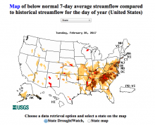
While it's been a wet winter for California, there are many places in the Eastern U.S. that experiencing below normal streamflow. Today's "Map of the Day" is from the U.S. Geological Survey WaterWatch program. The map identifies drought conditions ranging from extreme hydrological droughts to below normal streamflow conditions across the entire U.S. Follow Critical Issues on Twitter for daily maps, free webinars and resource updates.

