For more than 40 years, AGI's Data Sheets have been a critical tool for the geoscientist in field, the lab, and the classroom. For decades its bright orange cover and three-ring binding was distinctive in the geoscience community. The book evolved into its current, full-color and spiral bound format with the 2005 debut of the fourth edition.
AGI tapped some of the best minds in the geosciences to produce this fifth edition. Featuring the contributions of over 240 experts worldwide in their respective fields, the Handbook is over 470 full-color pages. Three years of work went into the Handbook to broaden its scope across the disciplines. The Geoscience Handbook is the quick reference tool for key metrics and concepts, a guide to cornerstone papers and recent developments, as well as short tutorials on topics that may not be familiar to all geoscientists.
Edited by Mark Carpenter and Christopher M. Keane
Graphics by Kathleen Cantner
ISBN: 978-0-922152-69-8; $59.99; 478 pages
Purchase Options
Sample Pages
Table of Contents
Geologic Time
1.1 Chronostratigraphic Stages of the Last 2.7 Ma
1.2 Major Geochronologic and Chronostratigraphic Units
1.3 International Commission on Stratigraphy Time Scale
1.4 Geomagnetic Polarity Timescale from Marine Magnetic Anomalies
1.5 Geologic Time and the Biosphere
1.6 Major Fossil Groups Used for Dating and Correlation of Phanerozoic Strata in North America
1.7 Geologic Time and Human Evolution
Solid Earth
2.1 Earth’s Lithospheric Plates
2.2 Age of the Oceanic Lithosphere
2.3 The World Magnetic Model 2015-2020
2.4 The Geoid
2.5 The Geoid in North America
2.6 Major Divisions of the Earth
2.7 Profile and Properties of Oceanic and Continental Crust
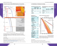
2.8 Earth’s Seismic Profile (PREM Model) and Composition
2.9 Distribution of Radioactive Heating
2.10 Physical Data about the Earth
Geologic Mapping
3.1 General Standards for Geologic Maps
3.2 Geologic Map Symbols
3.3 Lithologic Patterns for Stratigraphic Columns and Cross Sections
3.4 U.S. Public Land Survey Grid
Safety in the Field
4.1 Before You Leave
4.2 Field Research Safety Plan
4.3 Environmental Hazards and Diseases
Mineralogy
5.1 Mineral Hardness
5.2 The 7 Crystal Systems
5.3 The 14 Bravais Lattices
5.4 Macroscopic Identification of Common Minerals and Selected Optical Properties
5.5 Data Pertaining to Important Non-Silicate Minerals
5.6 The Role of the Microscope and Related Techniques
5.7 Routine Mineral Determination in Plane- and Cross-Polarized Light
5.8 Selected Mineral Properties in Thin Section
5.9 Michel-Levy Birefringence Chart
5.10 Selected Minerals under the Microscope
5.11 Identification of Peaks in the EDX Spectrum
5.12 Selected Crystals under the Scanning Electron Microscope (SEM)
5.13 Imaging Spectroscopy of Common Rock-forming Minerals
5.14 Geologic Materials and Human Health
Igneous Rocks
6.1 Tectonic Settings that Generate Magma
6.2 Phase Equilibria Diagrams for Mineralogy and Petrology
6.3 Bowen’s Reaction Series
6.4 Igneous Rocks: Components and Composition
6.5 Textures of Igneous Rocks
6.6 Thin Sections of Selected Igneous Rocks
6.7 Estimating Percentage Composition
6.8 IUGS Classifications of Plutonic and Volcanic Rocks
6.9 Chemical Classification of Igneous Rocks
6.10 Pyroclastic Sediments and Rocks
6.11 Characteristics of Fallout Tephra
Metamorphic Rocks
7.1 Metamorphic Environments
7.2 Pressure-Temperature-Time (P-T-t) Paths: Continental Collision
7.3 Metamorphic Facies
7.4 Classification of Metamorphic Rocks in the Field
7.5 Descriptive Classification of Metamorphic Rocks
7.6 Selected Textural Terms for Metamorphic Rocks
7.7 Common Metamorphic Rocks in Thin Section
7.8 Chemographic Diagrams: ACF, AKF, and AFM
7.9 Petrogenetic Grids for Metapelites
7.10 Stress and Strain Analysis
7.11 Conditions for Shock Metamorphism
Sedimentology
8.1 Total Sediment Thickness of the World’s Oceans and Marginal Seas
8.2 Sedimentary Basin Types and Subsidence Mechanisms
8.3 Global Crustal Volume and Mass of Sedimentary Rocks
8.4 Depositional Environments and Sedimentary Characteristics
8.5 Recognizing Sequence Boundaries and Other Key Sequence-Stratigraphic Surfaces in Siliciclastic Rocks
8.6 Lithofacies Classification Codes
8.7 Descriptions of Selected Sedimentary Structures
8.8 Core Examination and Stratigraphic Logs
8.9 Classification of Sedimentary Rocks
8.10 Selected Sedimentary Rocks in Thin Section
8.11 Grain-Size Scales and Data
8.12 Graphic for Determining the Size of Sedimentary Particles
8.13 Chart for Estimating the Roundness and Sphericity of Particles
8.14 Chart for Estimating the Sorting of Clastic Sediments
Structural Geology
9.1 Using a Brunton® Compass
9.2 Collecting Field Data Using Mobile Devices
9.3 Criteria for Determining Top and Bottom of Beds
9.4 Folds
9.5 Characterizing the Shapes of Folded Surfaces
9.6 Use of Mohr's Circle in Geology
9.7 Joints and Faults
9.8 Orientation Data and Discontinuities
9.9 Projection Nets
9.10 Correction for True and Apparent Dip
9.11 Physical Engineering Properties of Rocks
9.12 Physical Properties of Building Stones
Geochemistry
10.1 Periodic Table of Elements
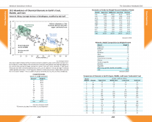
10.2 Abundance of Chemical Elements in Earth’s Crust, Mantle, and Core
10.3 Isotopic Variations in Mantle Materials
10.4 Commonly Studied Stable Isotopes and Applications
10.5 Geochemical Analysis of Igneous, Sedimentary, and Metamorphic Rocks
10.6 Chemical Weathering of Silicate Minerals in Igneous Rocks
10.7 Characterization of Solutions by pH and Eh
10.8 Organic and Inorganic Carbon: Reservoirs, Production, and Preservation
10.9 Organic and Inorganic Compounds, and Biogenic and Non-Biogenic Materials
10.10 Geochronological Methods
10.11 Instrumental Techniques Common To Analytical Mineralogy, Petrology, and Solid-Earth Geochemistry
10.12 Geochemistry Equations
Geophysics
11.1 Application of Geophysical Methods: Studying Earth’s Crust Using Seismic Reflection
11.2 Studying Earth’s Interior Using Seismic Tomography
11.3 Hydraulic Fracturing
11.4 Surface Methods
11.5 Geophysical Well Logging Techniques
11.6 Elements of Borehole Logging for Hydrocarbon Assessment
11.7 Summary of Geophysical Methods Applicable to Exploration and Geoenvironmental Studies
11.8 Geophysical Properties of Selected Materials
Energy Resources
12.1 Global Distribution of Major Oil and Gas Fields
12.2 Selected Geologic Characteristics of Major Oil Fields
12.3 Global Distribution of Proved Reserves in Oil, Natural Gas, and Coal
12.4 Shale Gas and Shale Oil Global Reserves
12.5 Major Trade Movements of Oil and Natural Gas
12.6 Reserves to Production (R/P) Ratios for Global Oil and Natural Gas
12.7 U.S. Energy Production, Trade, and Consumption 1950–2014
12.8 U.S. Petroleum Fuel Stocks by Type 1950–2014
12.9 Shale Gas Plays in the Lower 48 States
12.10 U.S. Production from Unconventional Gas Reservoirs
12.11 U.S. Coal Distribution and Production
12.12 Geothermal Heat Flow Map of the Conterminous United States
12.13 Production Costs for Petroleum and Alternative Fuel Resources
12.14 Crude Oil: Refinement, Products, and Consumption
12.15 Physical Properties of Crude Oil
12.16 Laboratory Analysis of Petroleum: Brent Crude Assay Example
12.17 Comparison of Selected Properties of Gasoline to Alternative Fuels
12.18 Energy Conversion Tables
Mineral Resources
13.1 Classification of Mineral Deposit Models by Litho-Tectonic Environment
13.2 World and U.S. Production, Imports, and Exports of Selected Non-Fuel Mineral Commodities
13.3 U.S. Net Import Reliance of Selected Non-Fuel Mineral Commodities
13.4 Major Metal and Industrial Mineral Producing Areas of the United States
13.5 The Rare Earth Elements
13.6 Minerals Found in Rare Earth Elements Deposits
13.7 Global Distribution of Rare Earth Elements
13.8 Classification of Deposits Containing Rare Earth Elements
13.9 Global Mine Production and Reserves of Rare Earth Elements
Earthquakes
14.1 Selected Major and Notable Earthquakes
14.2 Global Seismic Hazard Map
14.3 Global Seismographic Network
14.4 U.S. National Seismic Hazard Map
14.5 ShakeMap — A Tool for Earthquake Response
14.6 Earthquake Hazards Mitigation: PAGER from USGS
14.7 Geologic Study of Earthquake Effects
14.8 Fault-plane Solutions of Earthquakes
14.9 Checklist for Earthquake Effects
Volcanology
15.1 Remote Sensing Applications: Volcanic Eruptions
15.2 Monitoring Ground Deformation from Space Using InSAR
15.3 Global Distribution of Volcanoes
15.4 Global Distribution of Large Igneous Provinces
15.5 Volcanism, Large Igneous Provinces, and Mass Extinctions
15.6 Volcanic and Plutonic Regions in North and Central America
15.7 Morphologic Types of Volcanoes
15.8 Classification and Characteristics of Volcanic Eruptions
15.9 Selected Data Pertaining to Volcanic Activity
15.10 The Volcanic Explosivity Index
15.11 Volcano Monitoring by United States Volcano Observatories
15.12 Historic Volcanic Eruptions
Oceans
16.1 Selected Ocean Data
16.2 Global Histogram and Hypsographic Curve of Earth's Surface
16.3 Global Heat Transfer by the Oceans and Atmosphere
16.4 Global Map of M2 Tide
16.5 Sea Surface Temperature (SST)
16.6 Annual Salinity of the Ocean Surface
16.7 Ocean Temperature, Density and Nutrients at Depth
16.8 Physical Properties of Atlantic Water at Depth
16.9 Ocean Circulation: A Southern Hemisphere Perspective
16.10 El Niño and La Niña Southern Oscillation Events
16.11 Marine Carbon Production
16.12 Concentrations and Residence Times of Solutes in Seawater
16.13 Marine Carbonate Production and Buffering
16.14 Calcite and Aragonite Seas
Atmosphere
17.1 Sea-Level Pressure and Global Winds
17.2 Seasonal Radiation and the Redistribution of Heat
17.3 Composition of Air in Earth’s Troposphere
17.4 Natural and Anthropogenic Sources of a Selection of Trace Gases
17.5 Variation of Temperature, Pressure, and Composition with Altitude
17.6 Absorptivity of Selected Gases of the Atmosphere
17.7 Radiative Forcings from 1750-2010
17.8 Lapse Rates
17.9 The Radiosonde in Meteorology
17.10 Interpretation of Doppler Radar Imagery
17.11 The Saffir-Simpson Hurricane Wind Scale
17.12 The Fujita Tornado Damage Scale
17.13 The Beaufort Wind Scale
17.14 Action in Extreme Weather
17.15 Weather Symbols Used in Meteorology
Environmental Change
18.1 Common References to Time Periods in the Climate Literature
18.2 Changes in Global Glacial Mass Balance
18.3 Global Mean Sea-Level from Altimetry from 2005 to 2012
18.4 Monthly Sea Ice Extent Anomalies
18.5 Holocene Environmental Change
18.6 Processes that Remove Carbon Dioxide from the Atmosphere
18.7 Millennial Scale Climate Change in Greenland and West Antarctic over the last 90,000 years BP
18.8 Global Chronostratigraphic Correlation for the last 2.7 Ma
18.9 Late Pleistocene Sea Level and δ18O from 150 ka to Present
18.10 9 Million Year Climate Record from Foraminiferal δ18O Curves
18.11 Earth’s 65 Million Year Atmospheric CO2 History by Proxy
18.12 Estimated Record of Global Sea-Level for the Past 100 Million Years
18.13 Paleoclimate Proxies
Hydrology
19.1 Remote Sensing in Hydrology using GRACE
19.2 Global Hydrology
19.3 Hydraulic Characteristics of Groundwater Regions in the United States
19.4 Principal Aquifers of the United States
19.5 Hydrological Network Design: Station Density by Physiographic Region
19.6 Network Design: Data Requirements for Water Management
19.7 Metadata Fields for Recording Catchment Data
19.8 Recommended Accuracy of Hydrological Measurements
19.9 Hydrogeology Equations and Calculations
19.10 Groundwater Flow into a Well
19.11 Symbols, Units, and Conversion Factors
19.12 Modeling and Statistics in Hydrology
19.13 Commonly Used Frequency Distributions
19.14 An Overview of MODFLOW
19.15 USGS Water Resources Software
19.16 Selected Hydrologic Properties of Soil and Rock
19.17 Permeability Conversion Chart
19.18 National Primary Drinking Water Regulations
Geomorphology
20.1 Structure from Motion (SfM) Photogrammetry vs Terrestrial Laser Scanning
20.2 Geophysical Methods in Geomorphology
20.3 A Hierarchical Classification of Terrestrial Geomorphological Features by Scale
20.4 A Systems Approach to Geomorphology
20.5 Physiographic Regions of the United States
20.6 Uplift and Denudation
20.7 Chemical Weathering
20.8 Measuring Rock Hardness in the Field
20.9 Selected Characteristics of Fluvial Systems
20.10 Characterization of Alluvial Fans and Facies
20.11 Major Types of Landslide
20.12 Historic Landslide Hazards
20.13 Classification of Glacigenic Deposits
20.14 Selected Features of Desert Environments
20.15 Selected Characteristics of Coastal Environments
20.16 Types of Beaches
Soils
21.1 Soil Taxonomy
21.2 Checklist for Field Descriptions of Soils
21.3 Unified Soil Classification System
21.4 National Soils Map Dominant Orders and Suborders
Astronomy
22.1 Hertzsprung-Russell (H-R) Diagram and Pulsating Variable Stars
22.2 Compositions of the Sun, Chondrites, the Moon, and Continental Crust
22.3 Condensation of Materials from the Solar Nebula
22.4 Selected Stars Visible from Earth
22.5 Locations of Stars with Exoplanets
22.6 Properties of the Sun
22.7 Selected Properties of the Planets
22.8 Fraunhofer Lines and Solar Spectra
22.9 Magnetic Fields: Solar and Terrestrial
22.10 Sun Spots
22.11 Near Earth Objects
22.12 Space Weather


