This webinar provides an overview of landslide risk assessment and landslide impacts in the United States, discusses various policy approaches and funding for landslide risk mapping, and features case studies of work done with communities to reduce landslide risk.
Background:
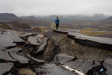
Landslides are a hazard that affects every U.S. state and territory, causing at least $1 billion in damage and 25–50 deaths annually in the United States. They include mudslides and debris flows, rockfalls, and slope failures, and occur due to both natural and human causes. The impacts of landslides can include damaged property, blocked or destroyed roads and other infrastructure, dammed streams and rivers (increasing flood risk), habitat loss, and loss of life. They can also occur in conjunction with other natural hazards such as floods, tsunami, earthquakes, and volcanic activity. Assessing and monitoring landslide risk helps to guide decisions that can reduce human and infrastructural vulnerability.
In this webinar, experts in landslide characterization, mapping, and risk reduction discuss landslide impacts in the United States; landslide research and mapping at the federal, state, and local levels; funding mechanisms for landslide mapping; and strategies for engaging communities in landslide risk reduction.
Our speakers are:
- Jonathan Godt, Acting Science Advisor for Earthquake and Geologic Hazards, U.S. Geological Survey |
 Slides |
  Video
Video - Jennifer Bauer, Co-Owner and Principal Geologist, Applachian Landslide Consultants |
 Slides |
  Video
Video - Eric Waage, Director, Hennepin County, MN Emergency Management |
 Slides |
  Video
Video
Additional Resources
 View this webinar's Question & Answer session
- U.S. Geological Survey - National Landslide Hazards Program
Search the Geological Surveys Database for reports and factsheets about landslides.
Media Partners and Sponsors
Thank you to our media partners, the American Geophysical Union, Association of American State Geologists, Association of Environmental & Engineering Geologists, American Meteorological Society, Geological Society of America, International Association of Emergency Managers, National Association of State Boards of Geology, Natural Hazard Mitigation Association, Seismological Society of America, Soil Science Society of America, and the U.S. Geological Survey (USGS).
This webinar is generously sponsored by:

