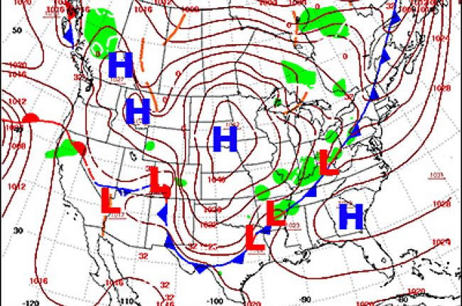
Why is the weather in high-pressure areas usually fair? Why is the weather in low-pressures areas usually cloudy and stormy? Most weather maps show areas, labeled with an H, where the atmospheric pressure is relatively high, and areas labeled with an L where the atmospheric pressure is relatively low. The isobars around such areas are closed curves with the approximate shape of circles. High-pressure areas are places where the atmosphere is relatively thick. Winds blow outward from these areas, although in a spiraling way. As air leaves the high-pressure area, the remaining air sinks slowly downward to take its place. That makes clouds and precipitation scarce, because clouds depend on rising air for condensation. High-pressure areas usually are areas of fair, settled weather. Low-pressure areas are places where the atmosphere is relatively thin. Winds blow inward toward these areas. This causes air to rise, producing clouds and condensation. Low-pressure areas tend to be well-organized storms.


