Large masses of air, as much as a thousand miles across, take on certain weather characteristics when they stay at high latitudes (near the poles) or at low latitudes (near the equator) for several days at a time. They may be very cold or very warm, or they may be very humid or very dry. Then, as they move into other areas, they can affect the weather there very strongly. The coldest winter weather in much of the United States is at times when a bitter cold air mass from the high arctic regions of northeastern Asia, Alaska, or northern Canada sweeps down into the southern parts of North America. At other times, a flow of warm and humid air from the tropics causes unusually warm weather in the eastern United States.
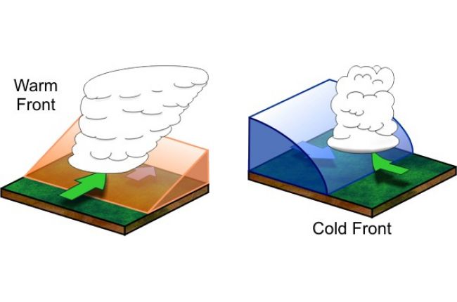
The boundaries between air masses are often zones of very rapid changes in temperature and moisture. Enormous swirling storms tend to develop along these zones of rapid change. On weather maps, cold fronts are shown as lines with triangular teeth. These show where the cold air mass is wedging under the warm air mass. As the warm air is lifted along the front, heavy rain from thunderstorms is common. Warm fronts are shown on weather maps as lines with circular teeth. These show where the warm air masses are moving up over the cold air masses. Broad areas of rain are often associated with warm fronts.


