Congressional Briefings
In collaboration with other scientific societies and coalitions, the AGI Geoscience Policy Program hosts congressional briefings to educate and inform policy makers on relevant geoscience topics and issues. These briefings feature scientific speakers from government, academic, and industry sectors.
(2018-06-25)
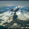
Volcanoes are one of the most fascinating natural phenomena on Earth, but their beauty can be deceiving. The expert panel of university and agency scientists at this briefing will discuss volcano monitoring from the subsurface, at ground level, and from the sky to explore these often-sleeping giants.
(2018-05-07)
Sinkholes have engulfed entire homes, sewer systems, and eight classic cars from the National Corvette Museum. However, with the help of science and technology, communities are developing solutions to the challenges of living in areas prone to sinkholes. These areas, also known as karst landscapes, cover more than one-fifth of the United States and can pose risks to lives and property.
(2017-11-29)
Geoscience information is integral to strengthening the economy of the last frontier. This briefing will highlight the importance of the geosciences for sustaining infrastructure, supplying energy to the nation, and expanding commerce in the Arctic.
At this widely attended briefing, learn more about the critical applications of geoscience information as communities brace for dynamic subsurface freezing and thawing, maritime trade routes expand, and new energy resources are discovered. In this dynamic landscape, geoscience is critical to inform economic decision making.
(2017-11-08)
Atmospheric rivers are a key feature of the global water cycle that produce significant amounts of rain and snow, particularly on the West Coast, and contribute to both water supply and flood risks. Although atmospheric rivers can provide beneficial precipitation, some of the more powerful events can disrupt travel, induce mudslides and other hazards, and cause catastrophic damage to life and property. Flash floods also pose a major threat to life and property, and usually occur as a result of torrential rain. These are a particularly dangerous type of flood because they combine the...
(2017-04-06)
Natural hazards affect every state in the nation. Earthquakes, volcanoes, landslides, tsunamis, hurricanes and other hazards, result in billions of dollars in annualized losses to the United States. These hazards threaten lives and property, disrupt services, damage infrastructure and threaten economies.
Mapping and monitoring of these hazards is a proven way to effectively save lives and protect our nation’s infrastructure.
(2016-07-12)
Lahars are rapidly rushing rivers of water and rock fragments that slide down volcanoes. They occur on the Aleutian volcanic arc in Alaska and the Cascade Range in the Northwest U.S. Lahars can flow down slopes at over 120 miles per hour and grow to 10 times their initial size.
Lahars can trap people in hazardous areas and move bridges, buildings, and other manmade structures caught in their flow. To better understand how and when lahars happen, scientists use technology to observe, describe, and model the events as they unfold.
(2016-06-22)
Robust data collections are vital for understanding and managing Earth’s natural resources and hazards:
Earthquake data can help identify quake-prone areas and inform earthquake preparedness.
Air quality data can reveal potential health risks and hazards from air pollution.
Water quality data can capture noteworthy trends and changes in safety and accessibility.
Ongoing efforts to build comprehensive and reliable data sets for various sectors of Earth Science help experts make informed decisions that keep communities safe.
(2016-05-16)
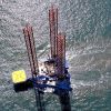
Offshore energy is a huge and growing resource. About 18 percent of U.S. oil and natural gas is produced offshore and production is growing. Globally, the offshore provides 30 percent of oil and natural gas. Offshore wind is also a growing source of electricity, especially in Europe. The U.S. has significant offshore wind power potential, but no commercial wind facilities are in development. Ongoing technological advancements assure all these resources will continue to grow while addressing heightened environmental concerns.
(2016-03-03)
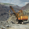
Critical minerals and materials are key components of the innovation economy. Minerals are a part of almost every product we use on a daily basis, either as the raw materials for manufacturing processes or as the end products themselves. Advanced technologies for communications, clean energy, medical devices, and national security rely on raw materials from mines throughout the world. In 2010, China curtailed exports of rare earth metals and sparked major concern about the security of global supply chains for a range of vital minerals and materials.
(2015-11-23)
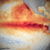
Join us for a congressional briefing to learn about El Niño. How does it form and what are the roles of the ocean and atmosphere? What impacts can be anticipated from the current event?What are the opportunities and challenges in understanding, monitoring, and predicting El Niño? A panel of leading experts will walk us through these questions and more.
Speakers:

