Information on this page was collected from the source acknowledged below:
Arizona Geological Survey:
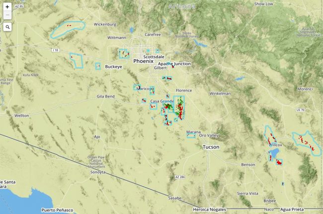
"Earth fissures are associated with basin subsidence that accompanies extensive ground water mining. In Arizona, fissures were first noted near Eloy in 1929. Their physical appearance varies greatly, but they may be more than a mile in length, up to 15 ft wide, and 100s of feet deep. During torrential rains they erode rapidly presenting a substantial hazard to people and infrastructure. Moreover, fissures provide a ready conduit to deliver runoff and contaminated waters to basin aquifers. Rapid population growth in southern Arizona is increasingly juxtaposing population centers and fissures.
Effective September 21, 2006, Ariz. Rev. Stat. § 27-152.01(3) charges the Arizona Geological Survey (AZGS) with 1) comprehensive mapping of earth fissures throughout Arizona, and 2) delivering earth fissure map data to the State Land Department to be posted online with other GIS map layers for the public to use to build their own customized maps."
For further information on the origin and impacts of earth fissures and free PDF maps of earth fissure study areas, visit the Arizona Geological Survey’s Earth Fissure Center.
Click here to access the Arizona Geological Survey's interactive map of earth fissures, now incorporated into an interactive map of multiple natural hazards in Arizona.
Source: Arizona Geological Survey

