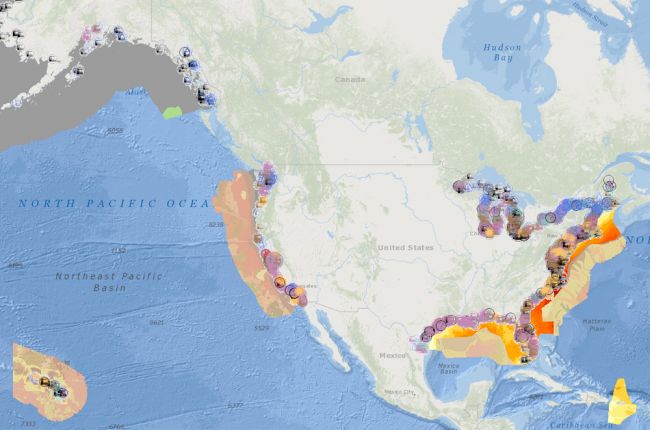
The Marine Cadastre National Viewer is a joint product of the U.S. Bureau of Ocean Energy Management (BOEM) and the National Oceanic and Atmospheric Administration (NOAA). The viewer contains an enormous amount of information relevant to marine and coastal issues in interactive map form. Over 275 different map layers are available on a wide range of topics. The geoscience-related layers include:
- Active offshore oil and gas leases, drilling platforms, oil and gas wells, selected pipelines, and BOEM planning areas
- Active offshore renewable energy leases and BOEM planning areas (wind energy and marine hydrokinetics)
- Offshore energy potential for ocean currents, tides, waves, and wind
- Offshore zones requiring different technologies for wind turbine placement based on water depth
- Detailed seafloor bathymetry
- Coastal energy facilities
- Seafloor geology
- Seafloor sediment type, texture, and thickness
- Ocean disposal sites
- Tropical cyclone (hurricane) exposure and historical cyclone paths
- Federal weather radar stations
- Major ocean uses by area for California, Oregon, Washington, Hawaii, New Hampshire, and Maine
Users can view these data on a wide variety of scales, and click on areas of interest for more detailed information, much of which is available for download and reuse.
Other layers include marine vessel traffic; distribution of corals; data on the distribution of marine mammals, fish, reptiles, and birds; detailed bathymetry; congressional districts; regions affected by a variety of marine and coastal legislation; shipping lanes and regulations; submarine cables; unexploded ordnances; fishing data; and shipwrecks.
Click here to access the Marine Cadastre National Viewer.
Sources: National Oceanic and Atmospheric Administration Office for Coastal Management, Bureau of Ocean Energy Management


