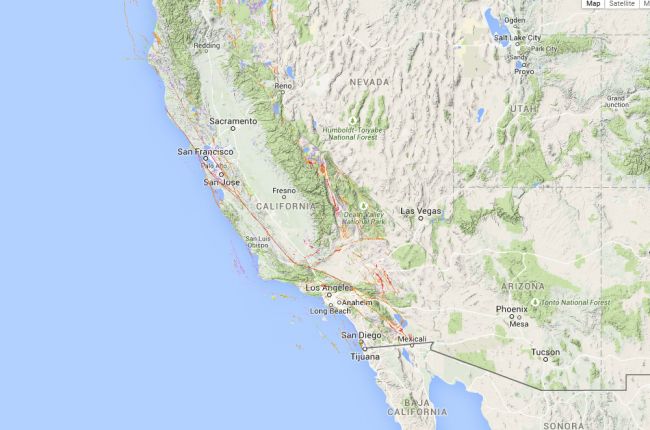
The California Geological Survey's interactive map allows users to identify the location and classification of faults throughout California. Information available includes the age of the most recent activity on each fault segment, surface rupture areas, and whether or not the faults are visible at the surface.
Click here to use the California fault activity map.
Source: California Geological Survey


