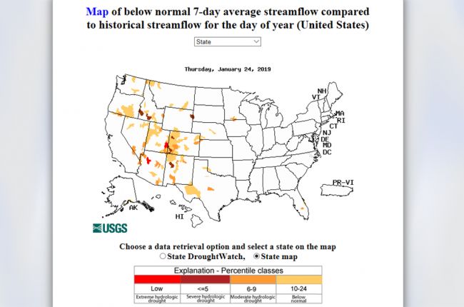
The U.S. Geological Survey's WaterWatch program maps below-normal 7-day average streamflow, identified through comparison to historical streamflow readings, to produce their DroughtWatch map. The map identifies drought conditions ranging from extreme hydrological droughts to below normal streamflow conditions across the entire U.S.
Click here to use the DroughtWatch interactive map

