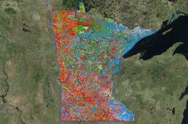
The Minnesota Department of Natural Resources' Watershed Health Assessment Framework provides a comprehensive look at Minnesota's watershed and environmental information in the form of an interactive map. The map includes information on:
- Water quality:
- Impaired waters, which have a customizable view so that you can select which specific contaminants or other impairment features you would like to map out
- Groundwater contamination susceptibility
- Watercourses, water bodies, and water use:
- Major streams and water bodies
- Altered watercourses, including farmland drainage channels
- Watershed information, including catchment discharge
- Groundwater provinces and management areas
- State water use permits
- Dams
- Soils:
- Percent sand, silt, clay, and organic matter
- Drainage class
- Erosion susceptibility
- Vegetation and ecology:
- Invasive species
- Mussel sites
- Indices of biological integrity
- Terrestrial habitat quality
- Perennial vegetation cover
- Climate data - mean annual temperature and precipitation
- Hazards - flood risk (100- and 500-year floodplains) and sinkholes
Many additional layers can be added to the map to include land cover, administrative/political boundaries, population density, and much more. Click on "Get more layers" in the map layer interface to add more layers to the map.
The map interface has tools for the analysis of individual catchments or rivers. By clicking on individual features you can find more information, and the map data can be downloaded for further use and analysis.
Click here to access the interactive map.


