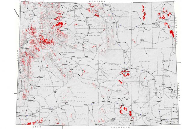
The Wyoming State Geological Survey has produced a map of recent and historical landslide activity in Wyoming, showing the location and extent of all mapped landslides.
Click here to access the WSGS landslide map.
Source: Wyoming State Geological Survey

