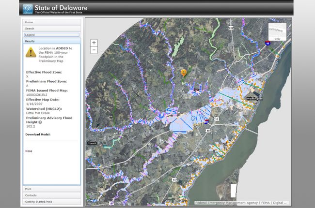
The Delaware Department of Natural Resources and Environmental Control (DNREC) Flood Tool is an interactive map with flood risk information. It is designed to help users make informed decisions about flood risk in specific areas and on specific properties.
For each location, the map shows the:
- Watershed,
- Effective flood zone,
- FEMA issued flood map,
- And whether the location is within the FEMA 100-year floodplain.
Additional map layers include the FEMA flood maps and the preliminary flood insurance rates map. Users can also incorporate data from other geospatial databases, such as the Advisory Flood Height or HEC-RAS models.
The “Getting Started/Help” tab on the left-hand toolbar describes how to use the interactive map.
Click here to access the Delaware Flood Planning Tool.
Source: Delaware Department of Natural Resources and Environmental Control (DNREC)

