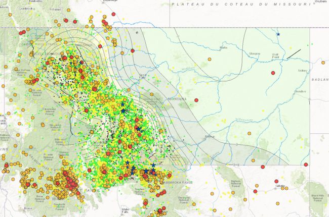
The Montana Bureau of Mines and Geology provides an online interactive map of earthquake information for Montana, much of Idaho and Wyoming, and nearby areas of Washington, Oregon, North Dakota, South Dakota, Alberta, and British Columbia.
The map provides the locations, dates, and magnitudes of historical earthquakes. For Montana only, additional map data include recently active faults, seismic hazard zones, and a generalized geologic map.
Click here to access the MBMG interactive earthquake map.

