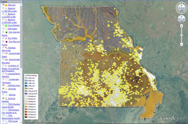
The Missouri Geological Survey's Geosciences Technical Resource Assessment Tool (GeoSTRAT) makes a large amount of geoscience information available in interactive map form, including:
- Surface and bedrock geology
- Hazards - earthquakes and sinkholes
- Geothermal energy resources
- Mineral resources - industrial mineral mines, abandoned mines, and metallic mineral waste management areas
- Oil and gas wells
- Water resources - springs, groundwater, dams, and water wells
The map allows users to select multiple layers that can be overlain on each other. By doing this, users can see how different features are related.
Note: to use the interactive map you must have the Google Earth Plug-In installed and enabled. Support for this plug-in will depend on your internet browser: Firefox and Internet Explorer will both support the plug-in, but Google Chrome may not
Click here to access the Missouri Geological Survey's interactive map
Source: Missouri Geological Survey

