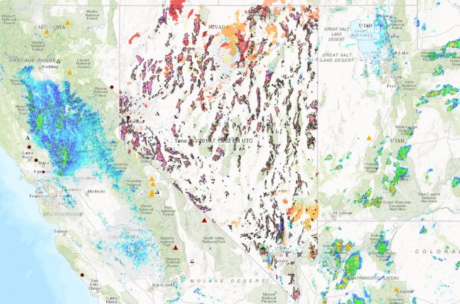
The Nevada Bureau of Mines and Geology's MyHAZARDS web app provides information on earthquakes, floods, fires, and other natural hazards in interactive map form. The map covers all of Nevada, as well as portions of surrounding states for certain datasets. The map includes:
- Recent and historical earthquakes, plus the national seismic hazard map
- Historical volcanic eruptions
- Current flooding events (live info)
- Current wildfire locations and perimeters (live info)
- Past burned areas by year
- Weather radar
- Outlooks for temperature, precipitation, wildfires, and drought (live info)
- Geologic units with possible radon risk
- Disaster damage and declarations (live info)
- Radon potential and average radon levels by zip code
A full geological map of Nevada is also provided, and layers can be overlain on each other to see how different features are related.
Click here to access the MyHAZARDS app.

