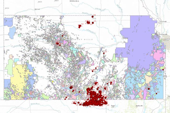
The Kansas Geological Survey's interactive map allows you to view a large amount of information on oil and gas resources and activity in Kansas. The interactive map includes:
- Oil and gas wells - data available for wells include permitting, dates of activity, current status, operator, field, lease, historical production, logs, and reports
- Oil and gas fields - data available for fields include thickness, depth, temperature, historical production, and operating companies
- Water wells
- Salt water disposal wells
- Earthquakes stronger then magnitude 2.0
Click here to access the interactive map of Kansas oil and gas resources
Source: Kansas Geological Survey

