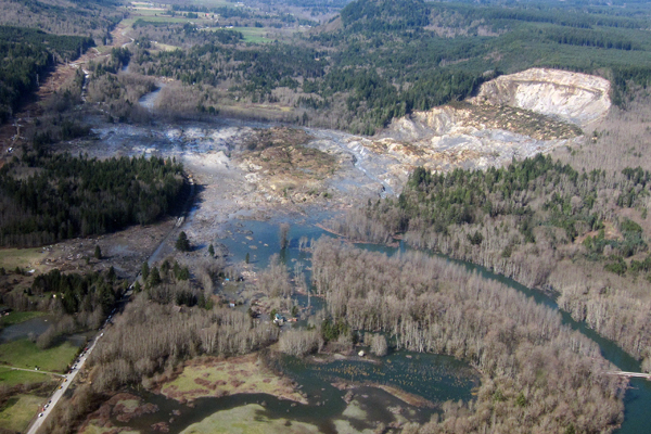
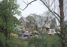
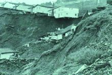
Landslides affect all 50 states and U.S. territories, where they cause 25 to 50 deaths and more than $1 billion in damages each year. Geoscientists study and monitor landslides to identify at-risk areas, prepare populations, and improve our understanding of why, when, and where landslides happen.
Basics
Landslides are masses of earth, rock, or debris that move down slopes. Landslides are triggered by one event, but many causes can weaken slopes over time and make them more likely to fail when there is a triggering event. These causes can be both natural and artificial. Landslides often occur in areas with oversteepened slopes, weak soils/bedrock, or de-vegetated slopes (whether by human deforestation or natural events such as wildfires).[1] Some of the most damaging landslides are triggered by water, typically from intense short-term rainfall or long-term saturation of the slope. Both natural and human activities (such as irrigation or seepage) can saturate hillsides. Earthquakes and volcanic eruptions also cause damaging landslides.[1] Read more
Frequently Asked Questions
Do you have a question that's not listed here? Search all FAQs
Explore Related Topics
Since 1900, earthquakes in the United States have resulted in over 1300 deaths and direct damages totaling more than $51 billion. While the West Coast and Alaska have the highest risk, history shows that major earthquakes can also affect the Central and Eastern United States.
Flooding is the most common and costliest natural hazard facing the United States. Each year, flooding causes billions of dollars in damages and dozens of deaths nationwide.
Natural hazards such as earthquakes, landslides, hurricanes, floods, and wildfires endanger public health and safety, threaten critical infrastructure, and cost our economy billions of dollars each year. Geoscientists study these hazards to provide information and warnings to populations at risk.
Sinkholes have both natural and artificial causes. They tend to occur most often in places where water can dissolve the bedrock (especially limestone) below the surface, causing overlying rocks to collapse. Florida, Texas, Alabama, Missouri, Kentucky, Tennessee, and Pennsylvania are most sinkhole-prone.
Tsunamis are destructive waves caused by sudden displacement of ocean water. Tsunamis most often appear on shore as a rapidly receding tide or rapidly rising flood. In the United States, the Pacific coastal states – Oregon, Washington, California, Alaska, and Hawaii – are at greatest risk for destructive tsunamis.
Volcanoes pose many hazards to their surroundings, from ashfall, mudflows, lava flows, landslides, and associated earthquakes. At least 54 of the United States' 169 active volcanoes pose major threats to public health and safety and to major industries such as agriculture, aviation, and transportation.
Wildfires are causing more frequent and wider-ranging societal impacts, especially as residential communities continue to expand into wildland areas. Since 2000, there have been twelve wildfires in the United States that have each caused damages exceeding $1 billion; cumulatively, these twelve wildfires have caused a total of $44 billion in damages.

