Geoscience in Your State: Vermont

PDF versionPDF version
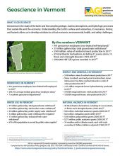
Cover of Geoscience Policy State Factsheet. Image credit: AGI

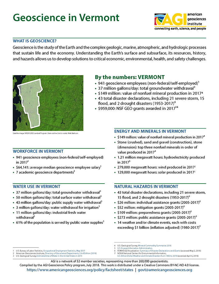
By the numbers: Vermont

  • 941 geoscience employees (excludes self-employed)1
  • 37 million gallons/day: total groundwater withdrawal3
  • $149 million: value of nonfuel mineral production in 20174
  • 43 total disaster declarations, including 21 severe storm, 15 flood, and 2 drought disasters (1953-2017)⁶
  • $959,000: NSF GEO grants awarded in 201714
  • ...

Agencies Working on Geoscience Issues in vermont

Vermont Center for Geographic Information

The Vermont Center for Geographic Information, a division of the Agency of Commerce and Community Development (VCGI), will provide strategic governance and deliver high quality geospatial data, services, solutions, infrastructure and expertise using methods that are efficient and effective, client-focused, and consistent with our enabling legislation.

Vermont Department of Environmental Conservation

The Vermont Department of Environmental Consrvation aims to preserve, enhance, restore, and conserve Vermont's natural resources, and protect human health for the benefit of this and future generations.

Vermont Emergency Management

Vermont Emergency Management manages and provides support to a number of emergency response agencies in Vermont. Programs managed by VEM include Debris Management, the Emergency Alert System, the National Incident Management System, the Radiological Emergency Response Plan, the State Emergency Response Commission, and VT-ALERT.

Vermont Geological Survey

The Vermont Geological Survey, also known as the Division of Geology and Mineral Resources in the Department of Environmental Conservation, conducts research and mapping relating to the geology, resources and topography of the State.

Case Studies & Factsheets

Cover of Geoscience Policy State Factsheet. Image credit: AGI

By the numbers: Vermont 941 geoscience employees (excludes self-employed)1 37 million gallons/day: total groundwater withdrawal3 $149 million: value of nonfuel mineral production in 20174 43 total disaster declarations, including 21 severe storm, 15 flood, and 2 drought disasters (1953-2017)⁶...

Cover of What Determines the Location of a Well

Introduction Oil- and gas-rich rocks are only found in certain parts of the United States, so most of the country has no oil or gas wells. Where oil and gas production is commercially viable, many factors determine the exact location of each well, including leasing, permitting, competing land uses...

Cover of AGI Factsheet 2018-004 - Present Day Climate Change

Climate Science 101 Climate is the average of weather conditions over several decades.1,2 Geoscientists monitor modern climate conditions (1880 A.D. to present) in part by taking direct measurements of weather data (i.e., air temperature, rainfall and snowfall, wind speed, cloudiness, and so on)...

CI_Factsheet_2017_5_drywellprograms_170906_thumb.JPG

Introduction Dry wells improve stormwater drainage and aquifer recharge by providing a fast, direct route for rainwater to drain deep into underlying sediment and rock. Dry wells are most common in the western U.S. where clay or caliche layers slow down the natural drainage of water into underlying...