By the numbers: Rhode Island
- 990 geoscience employees (excludes self-employed)1
- 33 million gallons/day: total groundwater withdrawal3
- $63 million: value of nonfuel mineral production in 20174 22 total disaster declarations, including 9 hurricane, 6 snow, and 5 severe storm disasters (1953-2017)⁶
- $8.9 million: NSF GEO grants awarded in 201714
What is...
Agencies Working on Geoscience Issues in rhode island
The Coastal Resources Management Council is a management agency with regulatory functions. Its primary responsibility is for the preservation, protection, development and where possible the restoration of the coastal areas of the state via the implementation of its integrated and comprehensive coastal management plans and the issuance of permits for work with the coastal zone of the state.
The Rhode Island Department of Environmental Management (DEM) serves as the chief steward of the state’s natural resources. The DEM's mission put simply is to protect, restore, and promote our environment to ensure Rhode Island remains a wonderful place to live, visit, and raise a family.
The mission of the Rhode Island Emergency Management Agency is to reduce the loss of life and property for the whole community while ensuring that as a state we work together to build, sustain, and improve our capability to prepare for, protect against, respond to, recover from, and mitigate all natural, human-caused, and technological hazards.
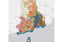
The mission of the Rhode Island Geological Survey and the Rhode Island State Geologist is to provide the people of Rhode Island with quality geologic information to facilitate informed decision-making for natural resource management, economic development, conservation planning, and regulation; to provide public assistance; and to promote education.
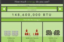
The Office of Energy Resources (OER) is Rhode Island’s lead state agency on energy policy and programs. The mission of OER is to lead Rhode Island to a secure, cost-effective, and sustainable energy future.
The Rhode Island Water Resources Board is an executive agency of state government charged with managing the proper development, utilization and conservation of water resources. Its primary responsibility is to ensure that sufficient water supply is available for present and future generations, apportioning available water to all areas of the state, if necessary.
The Environmental Data Center is the center of technical expertise in GIS for the state of Rhode Island. The (EDC) is a Geographic Information System (GIS) and spatial data analysis laboratory at the University of Rhode Island. The mission of the EDC is to support the use of contemporary tools of spatial data processing and electronic dissemination in the analysis and distribution of environmental data.


