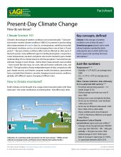
Geoscience in Your State: Tennessee

PDF versionPDF version
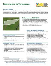
Cover of Geoscience Policy State Factsheet. Image credit: AGI

By the numbers: Tennessee

  • 5,302 geoscience employees (excludes self-employed)1
  • 430 million gallons/day: total groundwater withdrawal3
  • $1.14 billion: value of nonfuel mineral production in 20174
  • 68 total disaster declarations, including 31 severe storm, 17 flood, and 11 fire disasters (1953-2017)⁶
  • $2.22 million: NSF GEO grants awarded in...

Agencies Working on Geoscience Issues in tennessee

Tennessee Department of Environment and Conservation

The Tennessee Department of Environment and Conservation exists to enhance the quality of life for citizens of Tennessee and to be stewards of our natural environment by: protecting and improving the quality of Tennessee’s air, land, and water through a responsible regulatory system; protecting and promoting human health and safety; conserving and promoting natural, cultural and historic resources; and providing a variety of quality outdoor recreational experiences.

Tennessee Emergency Management Agency

TEMA's Mission is to coordinate preparedness, response, and recovery from man-made, natural, and technological hazards in a professional and efficient manner in concert with stakeholders.

Tennessee Geological Survey

The mission of the Tennessee Geological Survey is to encourage and promote the prudent development and conservation of Tennessee’s geological, energy and mineral resources by developing and maintaining data bases, maps and technical services; providing accurate geologic hazard assessments; and disseminating geologic information through publications and educational materials.

Case Studies & Factsheets

CI_Factsheet_2018_1_NewMadrid_180226_thumb.JPG

Earthquakes in the New Madrid Fault Zone The New Madrid fault zone (NMFZ) is a long-established weakness in the Earth’s crust in the central and eastern US where earthquakes have occurred for hundreds of millions of years. In 1811-1812, three large earthquakes (up to magnitude 7.5) caused severe...

Cover of Geoscience Policy State Factsheet. Image credit: AGI

By the numbers: Tennessee 5,302 geoscience employees (excludes self-employed)1 430 million gallons/day: total groundwater withdrawal3 $1.14 billion: value of nonfuel mineral production in 20174 68 total disaster declarations, including 31 severe storm, 17 flood, and 11 fire disasters (1953-2017...

Cover of AGI Factsheet 2018-004 - Present Day Climate Change

Climate Science 101 Climate is the average of weather conditions over several decades.1,2 Geoscientists monitor modern climate conditions (1880 A.D. to present) in part by taking direct measurements of weather data (i.e., air temperature, rainfall and snowfall, wind speed, cloudiness, and so on)...

CI_Factsheet_2017_5_drywellprograms_170906_thumb.JPG

Introduction Dry wells improve stormwater drainage and aquifer recharge by providing a fast, direct route for rainwater to drain deep into underlying sediment and rock. Dry wells are most common in the western U.S. where clay or caliche layers slow down the natural drainage of water into underlying...