Geoscience in Your State: Nebraska

PDF versionPDF version
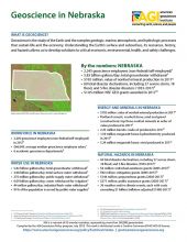
Cover of Geoscience Policy State Factsheet. Image credit: AGI

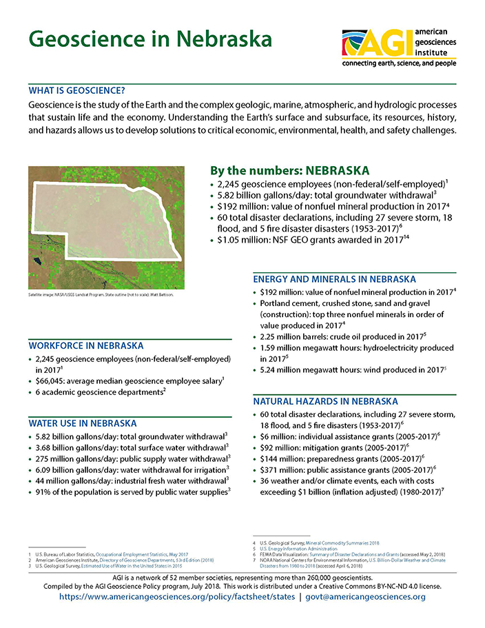
By the numbers: Nebraska

  • 2,245 geoscience employees (excludes self-employed)1
  • 5.82 billion gallons/day: total groundwater withdrawal3
  • $192 million: value of nonfuel mineral production in 20174
  • 60 total disaster declarations, including 27 severe storm, 18 flood, and 5 fire disaster disasters (1953-2017)6
  • $1.05 million: NSF GEO grants awarded in...

Agencies Working on Geoscience Issues in nebraska

Nebraska Department of Environmental Quality

The Nebraska Department of Environmental Quality was created pursuant to passage of the Nebraska Environmental Protection Act in 1971. Although the Department has grown and been given additional responsibilities over the years, its ongoing mission has remained the same - the protection of Nebraska’s air, land and water resources. 

Nebraska Department of Natural Resources

Finding a balance between competing demands is a key to Nebraska‛s resource future. Assessing impacts of alternative soil and water management options requires an understanding of complex issues and substantial amounts of reliable data. The Nebraska Department of Natural Resources (NDNR) is committed to providing Nebraska‛s citizens and leaders with the data and analyses they need to make wise resource decisions for the benefit of all Nebraskans both now and in the future. The NDNR is a State agency with responsibilities in the areas of: Surface Water, Groundwater, Floodplain Management, Dam Safety, Natural Resources Planning, Water Planning and Integrated Management, Storage of Natural Resources and Related Data, and Administration of State Funds.

Nebraska Emergency Management Agency

The Nebraska Emergency Management Agency is charged by state stature to reduce the vulnerabilities of the people and communities of Nebraska from the damage, injury and loss of life and property resulting from natural, technological or man-made disasters and emergencies.

Nebraska Geological Survey
The Survey's mission is to investigate and record information about Nebraska's geologic history, its rock and mineral resources, the quantity and quality of its water resources, land cover and other aspects of its geography, as well as the nature, distribution and uses of its soils.
Case Studies & Factsheets

Cover of AGI Factsheet 2018-004 - Present Day Climate Change

Climate Science 101 Climate is the average of weather conditions over several decades.1,2 Geoscientists monitor modern climate conditions (1880 A.D. to present) in part by taking direct measurements of weather data (i.e., air temperature, rainfall and snowfall, wind speed, cloudiness, and so on)...
CI_Factsheet_2017_2_groundwater_170309_thumb.JPG

Fresh water from underground Groundwater is any water found underground in the cracks and pores in soil, sand, or rock. Groundwater provides 25% of the fresh water used in the United States.1 It is particularly important for irrigation and domestic uses in arid or remote areas, where surface water...

Cover of Geoscience Policy State Factsheet. Image credit: AGI

By the numbers: Nebraska 2,245 geoscience employees (excludes self-employed)1 5.82 billion gallons/day: total groundwater withdrawal3 $192 million: value of nonfuel mineral production in 20174 60 total disaster declarations, including 27 severe storm, 18 flood, and 5 fire disaster disasters (...

CI_Factsheet_2017_5_drywellprograms_170906_thumb.JPG

Introduction Dry wells improve stormwater drainage and aquifer recharge by providing a fast, direct route for rainwater to drain deep into underlying sediment and rock. Dry wells are most common in the western U.S. where clay or caliche layers slow down the natural drainage of water into underlying...