By the numbers: North Carolina
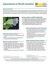
- 11,529 geoscience employees (excludes self-employed)1
- 520 million gallons/day: total groundwater withdrawal3
- $1.11 billion: value of nonfuel mineral production in 20174
- 59 total disaster declarations, including 25 hurricane, 8 flood, and 8 severe snow disasters (1953-2017)6
- $11.2 million: NSF GEO grants awarded in...
Agencies Working on Geoscience Issues in north carolina
The North Carolina Department of Environmental Quality provides science-based environmental stewardship for the health and prosperity of all North Carolinians. Divisions include: Air Quality, Coastal Management, Energy Mineral and Land Resources, Environmental Assistance, Environmental Education and Public Affairs, Marine Fisheries, Mitigation Services, Waste Management, Water Infrastructure, Water Resources.
The Division of Soil & Water Conservation, under the North Carolina Department of Agriculture & Consumer Services, provides programs, technical services and educational outreach promoting voluntary natural resource management and conservation on the private lands of NC through a non-regulatory, incentive-driven approach. The Division cooperates with federal, state and local partners to administer a comprehensive statewide program to protect and conserve the state's soil and water resources.
North Carolina Emergency Management works to enhance the state’s resiliency by actively collaborating, communicating and coordinating to prevent, mitigate, respond to and recover from disasters.
The North Carolina Geographic Information Coordinating Council (GICC) was established by the NC General Assembly to develop policies regarding the use of geographic information, geographic information systems (GIS), and related technologies.
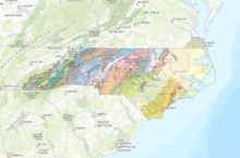
The mission of the North Carolina Geological Survey is to provide unbiased and technically accurate applied earth science information to address societal needs. This includes geologic maps, mineral resource and geochemical information, topographic maps and digital products, and earth science education initiatives. The agency examines, surveys and maps the geology, mineral resources and topography of the state, while encouraging the wise conservation and use of geologic resources by industry, commerce, agriculture and government for the general welfare of the citizens of North Carolina.

