By the numbers: Massachusetts
- 9,887 geoscience employees (excludes self-employed)1
- 380 million gallons/day: total groundwater withdrawal3
- $296 million: value of nonfuel mineral production in 20174
- 47 total disaster declarations, including 11 severe storm, 8 snow, and 7 flood disasters (1953-2017)6
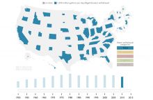
- $92 million: NSF GEO grants awarded in 2017...
Agencies Working on Geoscience Issues in massachusetts
Through the Bureau of Geographic Information (MassGIS), the Commonwealth has created a comprehensive, statewide database of spatial information for mapping and analysis supporting emergency response, environmental planning and management, transportation planning, economic development, and transparency in state government operations.
The health and happiness of people across Massachusetts depend on the accessibility and quality of our natural resources, recreational facilities, and great historic landscapes. DCR continues to improve the vital connection between people and the environment. DCR's focus is on improving outdoor recreational opportunities and natural resource conservation, restoring and improving our facilities, expanding public involvement in carrying out DCR's mission, and establishing first-rate management systems and practices.
MassDEP serves the Commonwealth by protecting natural resource areas that involve water, land and air. MassDEP enforces environmental laws, provides technical assistance to cities and towns, issues permits and licenses for activities near sensitive resources, inspects contaminated site cleanups, and partners with other federal and state agencies, municipal officials and environmental stakeholders.
MEMA coordinates with federal, state and local government agencies, non-profits and businesses to prepare, respond and recover from emergencies and disasters.
EEA seeks to protect, preserve, and enhance the Commonwealth’s environmental resources while ensuring a clean energy future for the state’s residents. The Executive Office of Energy and Environmental Affairs serves commonwealth residents interested in outdoor recreational opportunities, energy consumers and power companies, residents and businesses interacting with environmental protection laws and regulations, clean energy companies and residents interested in clean energy, farmers, and residents who work with animals.
The Massachusetts Geological Survey's mission is to perform research on the land, mineral, and water resources of the state; coordinate/facilitate research and communication among various agencies, researchers and stakeholders; collect, compile, analyze, correlate and preserve all data pertaining to the geological environment; disseminate to the public all information leading to a better understanding of the geology, hydrology, and natural environment through the preparation of maps, databases, reports and other publications.
CZM is the lead policy, planning, and technical assistance agency on coastal and ocean issues within the Executive Office of Energy and Environmental Affairs (EEA) and implements the state’s coastal program under the federal Coastal Zone Management Act. Through local and regional coordination and collaboration, CZM balances management of vital economic and natural resources of the Massachusetts coast and ocean waters. CZM provides technical assistance and support—primarily to local officials, marine businesses, environmental groups, and coastal homeowners—as well as information to people who visit and volunteer for the coast.


