Geoscience in Your State: Indiana

PDF versionPDF version
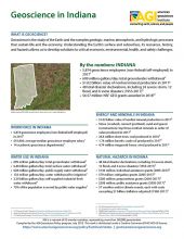
Cover of Geoscience Policy State Factsheet. Image credit: AGI

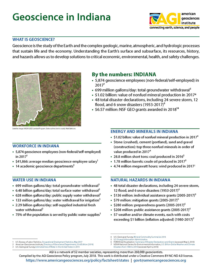
By the numbers: Indiana

  • 5,874 geoscience employees (excludes self-employed) in 20171
  • 699 million gallons/day: total groundwater withdrawal3
  • $1.02 billion: value of nonfuel mineral production in 20174
  • 48 total disaster declarations, including 24 severe storm, 12 flood, and 6 snow disasters (1953-2017)6
  • $6.57 million: NSF GEO grants awarded in 2018...

Agencies Working on Geoscience Issues in indiana

Indiana Department of Environmental Management

The Indiana Department of Environmental Management's mission is to implement federal and state regulations to protect human health and the environment while allowing the environmentally sound operations of industrial, agricultural, commercial and government activities vital to a prosperous economy.

Indiana Department of Homeland Security

The Indiana Department of Homeland Security works 24/7 to protect the people, property and prosperity of Indiana. For more information specific to Indiana's emergency management agencies, visit https://www.in.gov/dhs/4197.htm.


Indiana Department of Natural Resources

The mission of the Indiana Department of Natural Resources is to protect, enhance, preserve, and wisely use natural, cultural, and recreational resources for the benefit of Indiana's citizens through professional leadership, management, and education.

Indiana Geological and Water Survey

The mission of the Indiana Geological and Water Survey is to provide geologic information and counsel that contribute to the wise stewardship of the energy, mineral, and water resources of the state.

Case Studies & Factsheets

CI_Factsheet_2018_1_NewMadrid_180226_thumb.JPG

Earthquakes in the New Madrid Fault Zone The New Madrid fault zone (NMFZ) is a long-established weakness in the Earth’s crust in the central and eastern US where earthquakes have occurred for hundreds of millions of years. In 1811-1812, three large earthquakes (up to magnitude 7.5) caused severe...

CI_Factsheet_2017_5_drywellprograms_170906_thumb.JPG

Introduction Dry wells improve stormwater drainage and aquifer recharge by providing a fast, direct route for rainwater to drain deep into underlying sediment and rock. Dry wells are most common in the western U.S. where clay or caliche layers slow down the natural drainage of water into underlying...

Cover of AGI Factsheet 2018-004 - Present Day Climate Change

Climate Science 101 Climate is the average of weather conditions over several decades.1,2 Geoscientists monitor modern climate conditions (1880 A.D. to present) in part by taking direct measurements of weather data (i.e., air temperature, rainfall and snowfall, wind speed, cloudiness, and so on)...

Cover of Geoscience Policy State Factsheet. Image credit: AGI

By the numbers: Indiana 5,874 geoscience employees (excludes self-employed) in 20171 699 million gallons/day: total groundwater withdrawal3 $1.02 billion: value of nonfuel mineral production in 20174 48 total disaster declarations, including 24 severe storm, 12 flood, and 6 snow disasters (1953-...