Geoscience in Your State: Mississippi

PDF versionPDF version
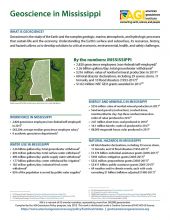
Cover of Geoscience Policy State Factsheet. Image credit: AGI

By the numbers: Mississippi

  • 2,820 geoscience employees (excludes self-employed)1
  • 2.26 billion gallons/day: total groundwater withdrawal3
  • $216 million: value of nonfuel mineral production in 20174
  • 68 total disaster declarations, including 29 severe storm, 11 tornado, and 10 flood disasters (1953-2017)6
  • $1.02 million: NSF GEO grants awarded in...

Agencies Working on Geoscience Issues in mississippi

Mississippi Department of Environmental Quality

The mission of the Mississippi Department of Environmental Quality is to safeguard the health, safety, and welfare of present and future generations of Mississippians by conserving and improving our environment and fostering wise economic growth through focused research and responsible regulation.

Mississippi Emergency Management Agency

The mission of the Mississippi Emergency Management Agency is to coordinate activities that will save lives, protect property and reduce suffering of Mississippi’s citizens and their communities impacted by disasters through a comprehensive and integrated program of disaster preparedness, response, recovery and mitigation initiatives.

Mississippi Office of Geology

The Office of Geology is the component of the Department of Environmental Quality responsible for research into the surface and subsurface geology, paleontology, and mineral resources of Mississippi; regulating the permitting of mines and the reclamation of surface-mined land; and administering the Mississippi Digital Earth Model (MDEM).

Mississippi Soil & Water Conservation Commission

The MSWCC guides, promotes and demonstrates the conservation, development, protection and proper utilization of the soil, water and related resources of the State. 

Case Studies & Factsheets

Cover of Geoscience Policy State Factsheet. Image credit: AGI

By the numbers: Mississippi 2,820 geoscience employees (excludes self-employed)1 2.26 billion gallons/day: total groundwater withdrawal3 $216 million: value of nonfuel mineral production in 20174 68 total disaster declarations, including 29 severe storm, 11 tornado, and 10 flood disasters (1953...

Cover of AGI Factsheet 2018-004 - Present Day Climate Change

Climate Science 101 Climate is the average of weather conditions over several decades.1,2 Geoscientists monitor modern climate conditions (1880 A.D. to present) in part by taking direct measurements of weather data (i.e., air temperature, rainfall and snowfall, wind speed, cloudiness, and so on)...

CI_Factsheet_2017_2_groundwater_170309_thumb.JPG

Fresh water from underground Groundwater is any water found underground in the cracks and pores in soil, sand, or rock. Groundwater provides 25% of the fresh water used in the United States.1 It is particularly important for irrigation and domestic uses in arid or remote areas, where surface water...

CI_Factsheet_2017_5_drywellprograms_170906_thumb.JPG

Introduction Dry wells improve stormwater drainage and aquifer recharge by providing a fast, direct route for rainwater to drain deep into underlying sediment and rock. Dry wells are most common in the western U.S. where clay or caliche layers slow down the natural drainage of water into underlying...

CI_Factsheet_2018_1_NewMadrid_180226_thumb.JPG

Earthquakes in the New Madrid Fault Zone The New Madrid fault zone (NMFZ) is a long-established weakness in the Earth’s crust in the central and eastern US where earthquakes have occurred for hundreds of millions of years. In 1811-1812, three large earthquakes (up to magnitude 7.5) caused severe...