Geoscience in Your State: North Dakota

PDF versionPDF version
Cover of Geoscience Policy State Factsheet. Image credit: AGI

By the numbers: North Dakota

  • 1,810 geoscience employees (excludes self-employed)1
  • 212 million gallons/day: total groundwater withdrawal3
  • $72 million: value of nonfuel mineral production in 20174
  • 57 total disaster declarations, including 28 flood, 20 snow, and 3 tornado disasters (1953-2017)6
  • $636,000: NSF GEO grants awarded in 201714...

Agencies Working on Geoscience Issues in north dakota

North Dakota Department of Emergency Services

The NDDES mission is to conduct planning, coordination, communications, and operations for the safety and security of all North Dakota citizens.

North Dakota Department of Environmental Quality

The North Dakota Department of Environmental Quality’s Vision is for a sustainable, high quality environment for current and future generations. Our Mission is to conserve and protect the quality of North Dakota’s air, land and water resources following science and the law.

In cooperation with the general public, industry and government at all levels, the department implements protective programs and standards to help maintain and improve environmental quality.

North Dakota Department of Health

The mission of the North Dakota Department of Health is to protect and enhance the health and safety of all North Dakotans and the environment in which we live. To accomplish our mission, the North Dakota Department of Health is committed to improving the health status of the people of North Dakota, improving access to and delivery of quality health care, preserving and improving the quality of the environment, promoting a state of emergency readiness and response, and achieving strategic outcomes within available resources.

North Dakota Department of Mineral Resources

The North Dakota Department of Mineral Resources is an agency of the North Dakota Industrial Commission. The Department consists of the North Dakota Geological Survey (including its paleontology program), the Pipeline Authority (established by the state legislature in 2007 to facilitate development of pipeline facilities), and the Oil and Gas Division (which regulates the drilling and production of oil and gas in North Dakota).

North Dakota Geological Survey

The North Dakota Geological Survey's mission is to investigate the geology of North Dakota; to administer regulatory programs and act in an advisory capacity to other state agencies; and to provide public service to the people of North Dakota.

North Dakota Public Service Commission

The Public Service Commission fulfills its statutory mandates by protecting the public interest and regulating utilities, mining companies, and licensees in a fair, efficient, responsive, and cooperative manner. Regulatory initiatives assure that utility customers receive reliable and safe service at reasonable and just rates; mined coal lands are reclaimed to provide a safe and productive environment now and in the future; and license and permit holders and operators of commercial weighing and measuring devices operate in a safe and fair manner.

North Dakota State Government

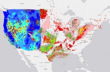
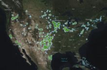
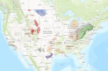
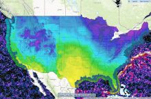
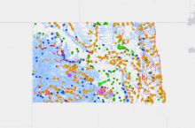
In addition to the wide variety of agencies working on geoscience issues within the North Dakota State Government, the Hub Explorer provides a large amount of information about geoscience and natural resources in the state.

Case Studies & Factsheets

Cover of AGI Factsheet 2018-002-Geologic Mapping and Public Health

Using Geologic Maps to Protect Public Health Geologic maps can be used to understand and mitigate public health risks across the US, in addition to their more traditional use in resource and infrastructure decisions. Geologic maps can show the location of naturally occurring hazardous materials and...

Cover of Water Sources for Hydraulic Fracturing

Hydraulic Fracturing and Water Demand Hydraulically fracturing a modern well can require millions of gallons of water for the initial fracturing process. This is a potential problem in arid regions with competing demands for fresh water (i.e. high water stress), such as Colorado and West Texas (see...
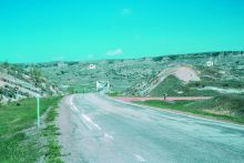
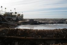
Fig. 3. U.S. Highway 85 crossing the Little Missouri River. Seventy-five percent of the rocks in this photograph, all of those in the foreground and the rocks along the north valley wall in the background have slid and are out of place. Credit: E. Murphy

Geologic maps can help to show which areas may be more prone to landslides and therefore directly assist in making optimum engineering design choices. Defining the Problem U.S Highway 85 and ND Highway 22, along with numerous county roads, buildings, pipelines, and power lines, have been...

CI_Factsheet_2017_5_drywellprograms_170906_thumb.JPG

Introduction Dry wells improve stormwater drainage and aquifer recharge by providing a fast, direct route for rainwater to drain deep into underlying sediment and rock. Dry wells are most common in the western U.S. where clay or caliche layers slow down the natural drainage of water into underlying...

Cover of Spills in Oil and Natural Gas Fields

Introduction Oilfield spills can harm wildlife and pose a risk to human health if they reach fresh water sources or contaminate soil or air. The enormous size of the oil and gas industry and the huge volumes of oil and produced water that are handled, stored, and transported result in thousands of...

Cover of Geoscience Policy State Factsheet. Image credit: AGI

By the numbers: North Dakota 1,810 geoscience employees (excludes self-employed)1 212 million gallons/day: total groundwater withdrawal3 $72 million: value of nonfuel mineral production in 20174 57 total disaster declarations, including 28 flood, 20 snow, and 3 tornado disasters (1953-2017)6 $...

Cover of Mitigating and Regulating Methane Emissions

Introduction Methane is the main component of almost all natural gas, and gas delivered to end-users is purified to 95-98% methane.1 There are three main sources of methane emissions from the oil and gas industry: When a well is being drilled, cleaned out, or hydraulically fractured. As the fluids...

Cover of AGI Factsheet 2018-004 - Present Day Climate Change

Climate Science 101 Climate is the average of weather conditions over several decades.1,2 Geoscientists monitor modern climate conditions (1880 A.D. to present) in part by taking direct measurements of weather data (i.e., air temperature, rainfall and snowfall, wind speed, cloudiness, and so on)...