Geoscience in Your State: South Dakota

PDF versionPDF version
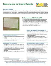
Cover of Geoscience Policy State Factsheet. Image credit: AGI

By the numbers: South Dakota

  • 1,505 geoscience employees (excludes self-employed)1
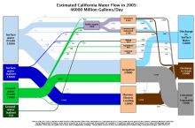
  • 238 million gallons/day: total groundwater withdrawal3
  • $372 million: value of nonfuel mineral production in 20174
  • 62 total disaster declarations, including 25 severe storm, 16 flood, and 14 fire disasters (1953-2017)⁶
  • $224,000: NSF GEO grants awarded in 201714 ...

Agencies Working on Geoscience Issues in south dakota

South Dakota Department of Environment and Natural Resources

To protect public health and the environment by providing environmental monitoring and natural resource assessment, technical and financial assistance for environmental projects, and environmental regulatory services; all done with reduced red tape, expanded e-government functions, and exceptional customer service to promote a prosperous economy while protecting South Dakota's environment and natural resources for today and tomorrow.

South Dakota Geological Survey

The mission of the Geological Survey Program is to perform scientific investigations that are designed to generate information on South Dakota's geologic and hydrologic resources. Fundamental aspects of those investigations are to include the collection, interpretation, and dissemination of geologic and hydrologic information leading to (1) a better understanding of the geology and hydrology of South Dakota, (2) better and easier use of the information by government, industry, and the public for decisions related to resource development and protection, (3) greater economic development, and (4) a better quality of life for South Dakota's citizens.

South Dakota Office of Emergency Management

The purpose of the OEM is to protect South Dakotans and their property from the effects of natural, manmade, and technological disasters.

Case Studies & Factsheets

Cover of Geoscience Policy State Factsheet. Image credit: AGI

By the numbers: South Dakota 1,505 geoscience employees (excludes self-employed)1 238 million gallons/day: total groundwater withdrawal3 $372 million: value of nonfuel mineral production in 20174 62 total disaster declarations, including 25 severe storm, 16 flood, and 14 fire disasters (1953-...

CI_Factsheet_2017_5_drywellprograms_170906_thumb.JPG

Introduction Dry wells improve stormwater drainage and aquifer recharge by providing a fast, direct route for rainwater to drain deep into underlying sediment and rock. Dry wells are most common in the western U.S. where clay or caliche layers slow down the natural drainage of water into underlying...

Cover of AGI Factsheet 2018-004 - Present Day Climate Change

Climate Science 101 Climate is the average of weather conditions over several decades.1,2 Geoscientists monitor modern climate conditions (1880 A.D. to present) in part by taking direct measurements of weather data (i.e., air temperature, rainfall and snowfall, wind speed, cloudiness, and so on)...

Cover of AGI Factsheet 2018-002-Geologic Mapping and Public Health

Using Geologic Maps to Protect Public Health Geologic maps can be used to understand and mitigate public health risks across the US, in addition to their more traditional use in resource and infrastructure decisions. Geologic maps can show the location of naturally occurring hazardous materials and...
CI_Factsheet_2017_2_groundwater_170309_thumb.JPG

Fresh water from underground Groundwater is any water found underground in the cracks and pores in soil, sand, or rock. Groundwater provides 25% of the fresh water used in the United States.1 It is particularly important for irrigation and domestic uses in arid or remote areas, where surface water...